Different parts of Nepal, including the Kathmandu Valley and various hilly regions, experienced rainfall since last night due to the combined influence of westerly and local winds, according to the Meteorological Forecasting Division (MFD). In its latest weather bulletin, the Division reported that these atmospheric conditions are currently dominating the nation’s weather pattern, bringing varying degrees of precipitation to multiple provinces.
The Division stated that moisture-laden winds entering from the Bay of Bengal are also playing a partial role in the current weather activity. These southern winds, known for carrying substantial humidity, have joined forces with the prevailing westerly and local systems, creating the conditions for rain and thunderstorms in several regions.
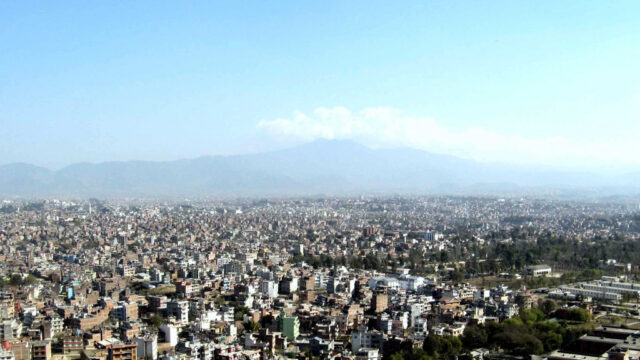
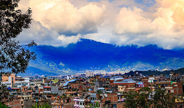
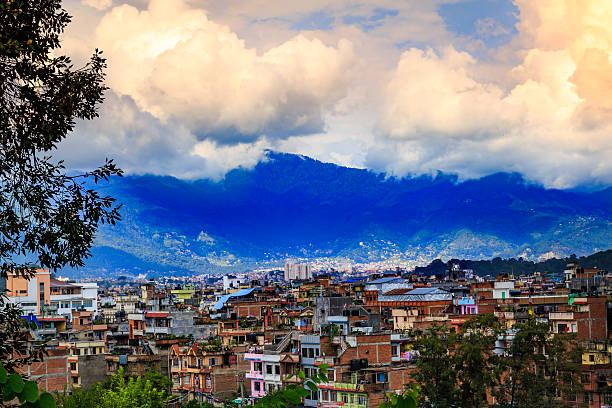
As of this morning, the Kathmandu Valley has been witnessing continuous light to moderate rainfall, bringing a temporary relief from the rising temperatures observed over the past week. The rainfall has led to cooler weather and increased humidity levels, offering a refreshing atmosphere for residents, though minor waterlogging has been reported in low-lying areas.
Nationwide Cloud Cover and Rainfall
According to the MFD, weather across Nepal is currently characterized by partial to general cloud cover. Particularly, the hilly regions of Koshi and Lumbini provinces have been highlighted as areas experiencing light to moderate rainfall accompanied by lightning. Such weather events are not unusual during the monsoon transition period, especially when local and large-scale weather systems converge.
“Currently, the country is under the partial influence of moisture entering from the Bay of Bengal in addition to active westerly and local winds. This interaction is resulting in widespread cloud formation and localized rainfall,” stated a meteorologist from the Division.
The weather forecast further indicates that the hilly regions of the country will remain partially to generally cloudy during the evening. Areas within the Gandaki and Karnali provinces may also see intermittent rain and thunderstorm activity. While the lowland Terai regions are expected to remain relatively drier, occasional showers cannot be ruled out, particularly in one or two locations across the region.
Forecast for the Evening and Coming Days
Looking ahead, the Meteorological Forecasting Division expects the current weather pattern to persist at least for the next 24 hours. Most hilly areas are likely to continue experiencing light to moderate rain, with a possibility of thunderstorms and lightning in scattered locations. The Division also noted that weather conditions might gradually improve toward the weekend if the westerly influence weakens.
In addition to Kathmandu, regions such as Pokhara, Dhankuta, Tansen, and Dhangadhi have reported light to moderate rainfall since early morning. Travelers and residents are advised to take necessary precautions, especially in areas prone to landslides and flash floods, as the ground has become saturated in several locations due to consistent rainfall in recent days.

The MFD urged citizens, particularly those in mountainous and hilly regions, to remain alert. “Thunderstorms and lightning are often accompanied by sudden gusts of wind, which could pose risks for outdoor activities, especially in remote and high-altitude areas,” the Division warned.
Impacts on Daily Life and Agriculture
While rainfall offers much-needed relief from heat and supports water recharge in rivers and groundwater sources, it also brings challenges in urban and rural areas alike. In Kathmandu Valley, minor traffic disruptions were observed in the morning due to slippery roads and poor visibility. Commuters were seen navigating through rain with umbrellas and raincoats as public transportation faced slight delays.
From an agricultural standpoint, the rainfall has been welcomed by many farmers who rely on natural precipitation to prepare their fields for upcoming seasonal crops. Particularly in regions like Palpa, Ilam, and Bhojpur, farmers have begun early paddy field preparations, expecting timely monsoon arrival.
However, prolonged or heavy rainfall could also be detrimental, particularly in areas where soil erosion and landslides are frequent during the rainy season. Local governments and disaster preparedness units are on standby to respond to any emergencies.

Advisory from the Meteorological Forecasting Division
The MFD continues to monitor the situation and has issued a general weather advisory for hilly and mountainous areas. “We request the public, especially trekkers and those traveling in high-altitude or rural areas, to stay updated with the latest weather forecasts before setting out,” said an official from the Division.
Air travelers are also advised to check with airlines for possible delays or changes in flight schedules, particularly for domestic flights to and from regions experiencing poor visibility due to rain and clouds.
As the monsoon season approaches, the Meteorological Division has intensified its monitoring and forecasting efforts. Regular updates will be published on its official website and through media outlets to keep the public informed about any significant developments.
Nepal’s current weather is a dynamic result of multiple interacting systems westerly winds, local circulations, and moisture from the Bay of Bengal. While this rainfall brings benefits such as agricultural support and temperature moderation, it also calls for public caution due to associated risks like lightning, slippery roads, and potential landslides. The Meteorological Forecasting Division encourages people to stay alert and informed as the country navigates this seasonal transition.