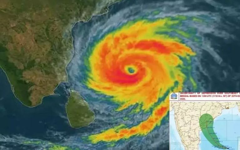
A weather system developing over the Bay of Bengal could influence weather conditions across Nepal in the coming days, with possible snowfall in the Himalayan region, according to a GFS model forecast shared through the Nepal National Mountain Guide Association (NNMGA) in association with senior meteorologist Krishna Bhakta Manandhar.
The forecast outlines the system’s possible development from October 25 to 31, 2026, and suggests that its movement toward eastern India and the Gangetic plains could bring increased cloud cover and precipitation to parts of Nepal. However, these are model based predictions, and actual conditions may change as the system develops.
Weather System Expected to Strengthen Over the Bay of Bengal
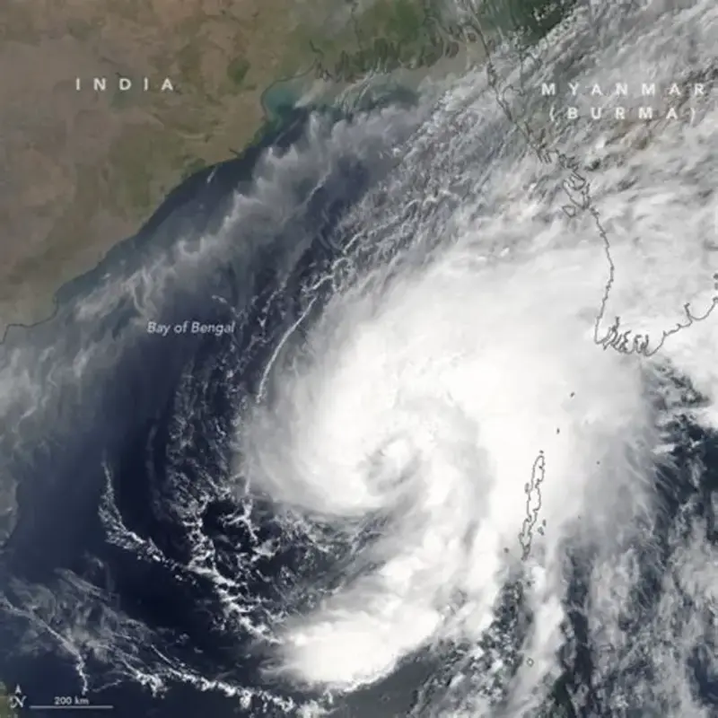
According to the shared GFS model analysis, a significant weather system was developing over the east central Bay of Bengal on October 24. The system was forecast to strengthen into a depression on October 25 and a deep depression over the west-central Bay of Bengal on October 26.
The forecast further suggested that the system could develop into a cyclone near the coast of Andhra Pradesh on October 27 before moving inland toward Andhra Pradesh and southern Odisha around October 28. Its eventual track and intensity could influence weather conditions across parts of the Indian subcontinent, including the Himalayan region.
Eastern Nepal Himalayas Could See Light Snowfall
The forecast indicates that higher level clouds could begin affecting Nepal around October 28, particularly over the eastern Himalayas. Areas around the Khumbu region and Kanchenjunga could experience occasional light snowfall of approximately 1 to 2 centimeters at elevations above 6,500 to 7,000 meters.
These early changes may primarily affect high altitude mountain areas, where weather conditions can shift rapidly. The predicted snowfall remains conditional on the system’s development and its eventual movement, so the forecast should not be interpreted as confirmation that snowfall will occur.
Weather Activity Could Increase Between October 29 and 30
The GFS model analysis suggests that the remnants of the weather system could move toward the Gangetic plains of India and adjoining areas of Nepal between October 29 and 30. During this period, the forecast indicates the possibility of more significant weather activity and heavier snowfall across Nepal’s Himalayan region, particularly at elevations where temperatures remain suitable for snow.
The potential effects will depend on the system’s remaining moisture, its movement, and local atmospheric conditions. Mountain communities, trekkers, climbers, and tourism operators should follow updated weather forecasts and official advisories rather than relying on a single early model prediction.
NNMGA Shares Forecast in Association With Senior Meteorologist
The weather analysis was shared as a social initiative of the Nepal National Mountain Guide Association (NNMGA) in association with senior meteorologist Krishna Bhakta Manandhar. The information highlights the potential effects of the developing Bay of Bengal system on Nepal’s high altitude regions during the final days of October.
The forecast also indicates the possibility of lingering cloud cover or light snowfall on October 31, depending on how the system evolves. The photograph accompanying the original forecast was credited to Ram Bahadur Gurung of NNMGA. Further updates from the Department of Hydrology and Meteorology should be consulted for official forecasts and warnings.